Monday, November 13, 2023

Week 13: Coastal Hazards


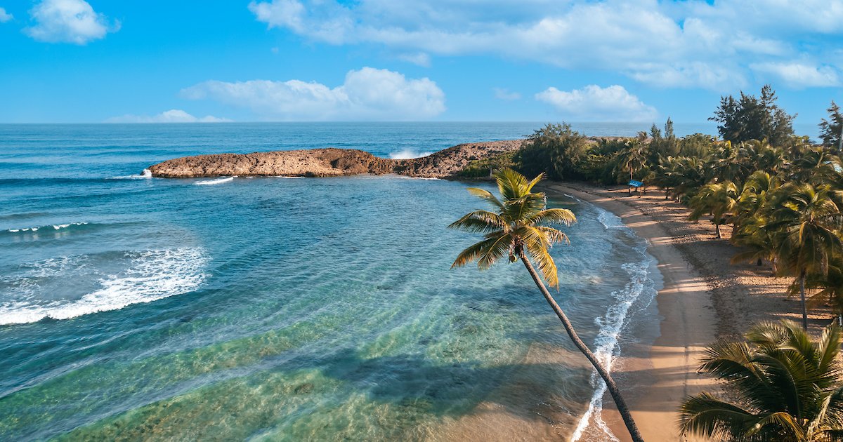
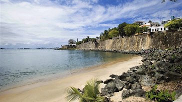
Hurricanes, tsunamis, floods, and storm surges are just a few of the natural coastal hazards that Puerto Rico suffers as part of the Caribbean island. Communities in Puerto Rico are highly to very sensitive to coastal hazards due to the island's high population density (430/km2) and concentrated development in the coastal zone. 60% of the beaches are eroding on the island, making the island more susceptible to coastal hazards like the impacts of Hurricane Maria in 2017 that hit the island. 

The USGS currently has a total water level forecast on sandy beaches that serve the eastern coast of the United States and the Gulf of Mexico. In order to accomplish this effort, they are working on cameras that will take pictures of the beach that can be accessed in real-time remotely from their office in St. Petersburg. In addition, they need instruments in the water, so they deploy oceanographic instruments to better understand how waves move across coral reefs into the shorelines. With this information, they can measure waves before they reach the reef to study how the reef helps dissipate wave energy and to develop the water level forecast for the island. 

This susceptibility of being affected by coastal hazards is frequently made worse by careless coastal construction methods, the devastation of mangroves and other coastal habitats, and inadequate enforcement of environmental regulations. Reducing risk and loss of life and property through technology and information provided by Sea Grant researchers and marine advisers active in risk management and mitigation remains the major challenge. Through funding research initiatives that have resulted in flood models and maps, tsunami simulation tools, and public perceptions of risk, Sea Grant researchers encourage socioeconomic assessments that provide insight into the effects of coastal disasters on the economy and the efficacy of mitigation measures. Mitigation must come through prohibiting construction in high-risk zones, encouraging wider adoption of setback principles (e.g., Villa Palmira), relocating after storms, enforcing anti–sand-mining regulations, and better public education.

Sources: 

https://www.usgs.gov/media/videos/puerto-rico-coastal-hazards

https://seagrantpr.org/outreach-program/coastal-hazards/

https://pubs.geoscienceworld.org/gsa/books/book/615/chapter-abstract/3805192/Summary-of-Puerto-Rico-s-vulnerability-to-coastal?redirectedFrom=fulltext

Saturday, October 21, 2023

Week 10: Extreme Weather

While circulation changes are mostly responsible for changes in the average amount of precipitation, extremes are far more susceptible to the thermodynamic state and conditions on certain days. Extremes can only happen when numerous preconditions come together. Extreme rainfall, for instance, necessitates enhanced ("potential") moisture transport into the area, high temperatures (or strong temperature gradients), and severe atmospheric instability. It is comparatively uncommon for these "ingredients" to align. A combination occurrence can also be more likely if that one condition—higher temperatures—is met more frequently. The Clausius-Clapeyron Relationship states that for every 1 degree Celsius increase in air temperature, that air's capacity to carry moisture increases by 7%. This makes warmer temperatures particularly significant for precipitation. As a result, the warmer the air, the more moisture it can hold; as a result, if rain formed, much more water could be extracted from it.

The following are Puerto Rico's all-time extremes. On October 7th, 1985, the Toro Negro Forest received 23.75 inches of rainfall during a 24-hour period. The record-breaking high temperature was 104 degrees, which was recorded on Mona Island on July 2, 1996. On March 9th, 1911, Aibonito recorded the coldest temperature ever, which was 40 degrees. 

Despite being susceptible to earthquakes, tsunamis, and wildfires, tropical storms and drought pose the greatest threat of disaster to Puerto Rico. Long-term drought affects cattle, agriculture, and water supplies while raising the danger of wildfires. Maria was the most powerful tropical storm to strike Puerto Rico since 1928. Extreme drought that affected much of the larger Caribbean region from 2014 to 2016 also affected Puerto Rico. In Puerto Rico, 2015 was the third driest year. Businesses were briefly shuttered, there were tight water restrictions in place, and crops and livestock were lost.

The wettest months in Puerto Rico are April through November, and the driest months are December through March. Because of the geography of the island, annual rainfall varies substantially from Magueyes Island's 29.32 inches to Pico del Este's 171.09 inches on average. 

In September, Puerto Rico experienced its most recent heat wave, recording a record-breaking 47 nights with temperatures exceeding 80 degrees Fahrenheit. When asked if their classrooms had air conditioning during the heat wave, 83% of instructors responded that they did not.


https://climateknowledgeportal.worldbank.org/country/puerto-rico/extremes

https://www.weather.gov/sju/climo_extremes

https://www.climatehubs.usda.gov/hubs/caribbean/topic/disaster-preparedness-puerto-rico-and-us-virgin-islands#:~:text=Though%20vulnerable%20to%20earthquakes%2C%20tsunamis,%2C%20tropical%20storms%2C%20and%20drought.

https://www.nbcnews.com/news/amp/rcna103923

Saturday, October 7, 2023

Week 8: Mass Wasting Hazards (Landslides)

On September 20, 2017, Hurricane Maria struck the island of Puerto Rico, causing more than 40,000 landslides in at least three-fourths of Puerto Rico's 78 municipalities. The majority of landslides were shallow, but there were occasionally deeper ones as well. These occurred before, during, and following flooding, and many developed into extended runout debris flows. Due to the already wet soils, steep slopes in hilly and mountainous areas were severely affected by landslides. 

The USGS Landslide Hazards Program seeks to lessen the effects of landslides on people and infrastructure by advancing people's knowledge of the causes of ground failure and by suggesting risk-reduction measures. USGS researchers have carefully examined rainfall-induced landslides in Puerto Rico to produce maps showing landslide susceptibility. Residents and emergency managers have access to educational resources that present scientific ideas in an understandable manner. The USGS has been closely collaborating with local partners to study landslides caused by significant rainfall events like Hurricane Maria in order to better understand rainfall-induced landslides in Puerto Rico. Scientists can depict landslide parameters like magnitude, failure mode and style, mobility of debris slides, flows of geologic material, location, and timing using remote sensing techniques and field observations. Local scientists and USGS scientists have collaborated to calculate landslide risk using this data as well as other crucial variables like proximity to roads and streams. The stream system experienced a high volume of eroded soil from the landslides. This sudden shift in chemical weathering measurements over a brief span of time does not suggest a significant alteration in climate. Instead, it is likely due to minor changes in the way landslides transport sediment to streams. When cations from silicate weathering combine with carbonate minerals downstream, even small landslides can have a significant impact on carbon sequestration, as seen in the post-hurricane changes in stream chemistry.


https://www.usgs.gov/supplemental-appropriations-for-disaster-recovery-activities/landslides-triggered-hurricane-maria
https://www.usgs.gov/mission-areas/natural-hazards/science/puerto-rico-natural-hazards-landslides-peligros-naturales-de
https://agupubs.onlinelibrary.wiley.com/doi/abs/10.1029/2021JF006509

Monday, September 18, 2023

Week 5: Volcanoes

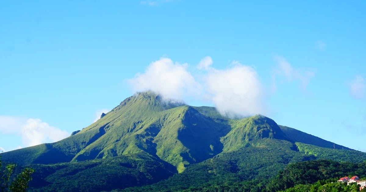
The volcano of Mount Pelee in MartiniqueCurrently, there are no active volcanoes in Puerto Rico and the Virgin Islands; the last volcanoes were active approximately 30 million years ago. The nearest volcano to Puerto Rico is Mount Pelée, an active stratovolcano near the northern end of Martinique, an island and French overseas territory in the Caribbean's Lesser Antilles Volcanic Arc. Its volcanic cone comprises stacked layers of ash and lava that have been cemented. 1932 saw its most recent eruption. It is considered the most active volcano in the Caribbean. At least four eruptions have occurred in the prior 250 years, including phreatic eruptions in 1792 and 1851 and, more recently, magmatic eruptions that produced lava domes in 1902–1905, 1929–1932, and elsewhere. Some mitigation efforts for Mount Pelée include creating hazard maps, studying the volcano, and creating a disaster plan in the instance that another catastrophic eruption occurs. When the volcano erupted in 1932, the post-disaster mitigation efforts included: bringing boats to remove survivors, evacuating the nearby towns, providing monetary support for the displaced people, and donations from all around the world. 


https://tourcrib.com/en/blog/vacation/martinique-volcano-pelee

https://volcano.si.edu/volcano.cfm?vn=360120

https://www.nsm.buffalo.edu/courses/gly433/pdfPowerPoint/Hanson.pdf

https://pages.mtu.edu/~gbluth/Teaching/GE4150/lecture_pdfs/L8_pelee.pdf

https://oceanexplorer.noaa.gov/okeanos/explorations/ex1811/background/geology/welcome.html#:~:text=There%20are%20currently%20no%20active,8%2C300%20meters%20(5.2%20miles).

Sunday, September 3, 2023

Week 3: Earthquakes

Although Puerto Rico has historically had moderate seismicity, the territory is tectonically active, thus rare big earthquakes are to be expected. A total of 576 earthquakes with a magnitude of four or above have struck within 300 kilometers (186 mi) of Puerto Rico in the past 10 years. This comes down to a yearly average of 57 earthquakes per year, or 4 per month. On average an earthquake will hit near Puerto Rico roughly every 6 days.

 PR quakes

The spread of seismicity southwest of Puerto Rico in December 2019 and January 2020 is depicted in the above graph. According to the time of the earthquake in relation to December 28, 2019, earthquake symbols are colored and sized by magnitude.

Seismicity and seismic monitoring stations

Seismic activity is depicted on the map above as orange circles and seismic monitoring stations as triangles. Recent upgrades to seismic stations are shown in red.

In order to avoid a catastrophic earthquake:

Through the Emergency Management Assistance Compact, the Commonwealth of Puerto Rico has asked the states of California and New York for help. The teams will offer technical support for building evaluations and inspections, as well as for the management and disposal of debris in the earthquake-affected districts.

The limited infrastructure evaluation, security/reconnaissance activities, evacuation support, and route clearance operations are all being helped by the Puerto Rico National Guard. To help, more teams are on their way.

Six temporary seismometers are being placed by the USGS along the coastline around the epicenters of the earthquakes. The ability to describe and anticipate earthquakes will be improved by data from aftershock monitoring devices.


As the complicated and ongoing recovery from Hurricanes Irma and Maria continues, FEMA continues to assist the government of Puerto Rico. It also works to ensure that everyone is better prepared for catastrophes that could affect the island at all levels.

References: 

https://www.usgs.gov/news/featured-story/magnitude-64-earthquake-puerto-rico

https://www.fema.gov/press-release/20230425/fema-and-other-federal-agencies-supporting-earthquake-response-puerto-rico

https://earthquakelist.org/puerto-rico/


Monday, August 28, 2023

Week 2: Plate Tectonics

Puerto Rico Trenchmap of Earth in puzzle pieces

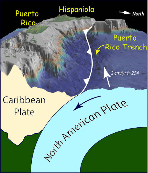
Figure 2. Cross section view looking west showing how the Puerto Rico Trench forms between the obliquely subducting North American Plate and the overriding Caribbean Plate. Bathymetry data generated using the Global Multi-Resolution Topography (GMRT) synthesis in GeoMapApp.

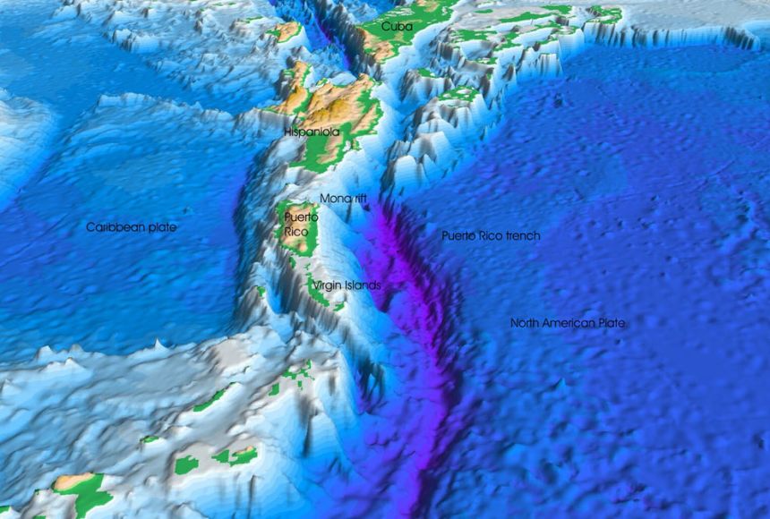
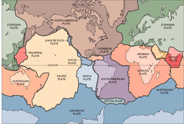
Puerto Rico is located on an active tectonic border where the Caribbean and North American plates meet. The northeastern corner of the Caribbean plate is migrating eastward at a rate of around two centimeters per year, on a strike-slip fault. A strike-slip fault occurs when blocks have typically shifted horizontally over vertical (or nearly vertical) fractures. Puerto Rico is located on a transform boundary, which happens when the margins of two plates glide past one another.

Puerto Rico is situated on a transform fault, which causes the plates to shift either horizontally or vertically. A massive transform fault that stretches from the Puerto Rico Trench to the coast of Central America is the result of the Caribbean and North American tectonic plates rubbing against one another. While the North American plate is moving west, the Caribbean plate is moving east. 

The Caribbean plate's northern boundary is sub-parallel to the relative motion of the two plates, causing the plates to largely glide past one another. The North American plate is partially convergent with the Caribbean plate and is being indirectly subducted beneath Puerto Rico, however, the motion is somewhat oblique to the plate boundary. 

The Puerto Rico Trench is connected to both the transform fault and a subduction zone. East of the trench, the larger Caribbean plate is being subducted beneath the larger North American plate, which carries the continent of North America and the northern Atlantic Ocean.

The region is very seismically active with an average of five earthquakes (including aftershocks) with a magnitude greater than 1.5 occurring near Puerto Rico every day during the last 12 months (March 2014-March 2015). Although the vast majority of these earthquakes are too small to be felt by people, these earthquakes provide evidence that the North American plate is moving westward relative to the Caribbean plate at about two centimeters/year.

Fun fact: Near the Puerto Rico trench, a vast fault system known as the Bunce Fault was found. The San Andreas Fault in California and the Bunce Fault are strikingly similar. Dr. Elizabeth (Betty) Bunce, a marine geophysicist who studied the Puerto Rico Trench in the 1950s, is honored with the name of the Bunce Fault.

https://education.nationalgeographic.org/resource/puerto-rico-trench/#:~:text=The%20Caribbean%20and%20North%20American,American%20plate%20is%20shifting%20west.

https://www.usgs.gov/programs/cmhrp/news/scientists-map-tectonic-structure-below-seafloor-puerto-rico#:~:text=Puerto%20Rico%20lies%20on%20an,along%20a%20strike%2Dslip%20fault.

https://www.usgs.gov/media/videos/strike-slip-fault#:~:text=Strike%2Dslip%20faults%20are%20vertical,motion%20is%20termed%20left%2Dlateral.

https://oceanexplorer.noaa.gov/okeanos/explorations/ex1502/background/geology/welcome.html

Monday, August 21, 2023

Puerto Rico


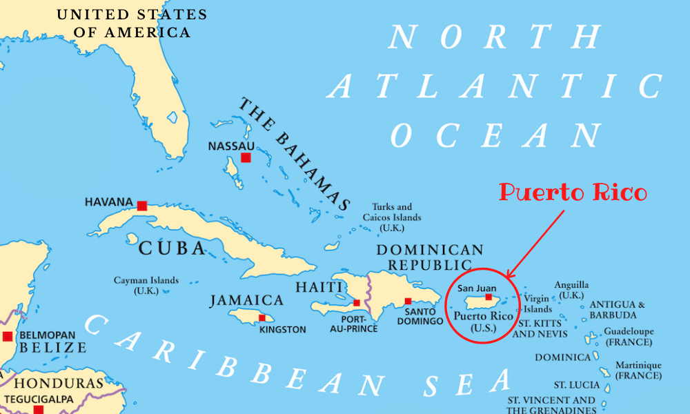
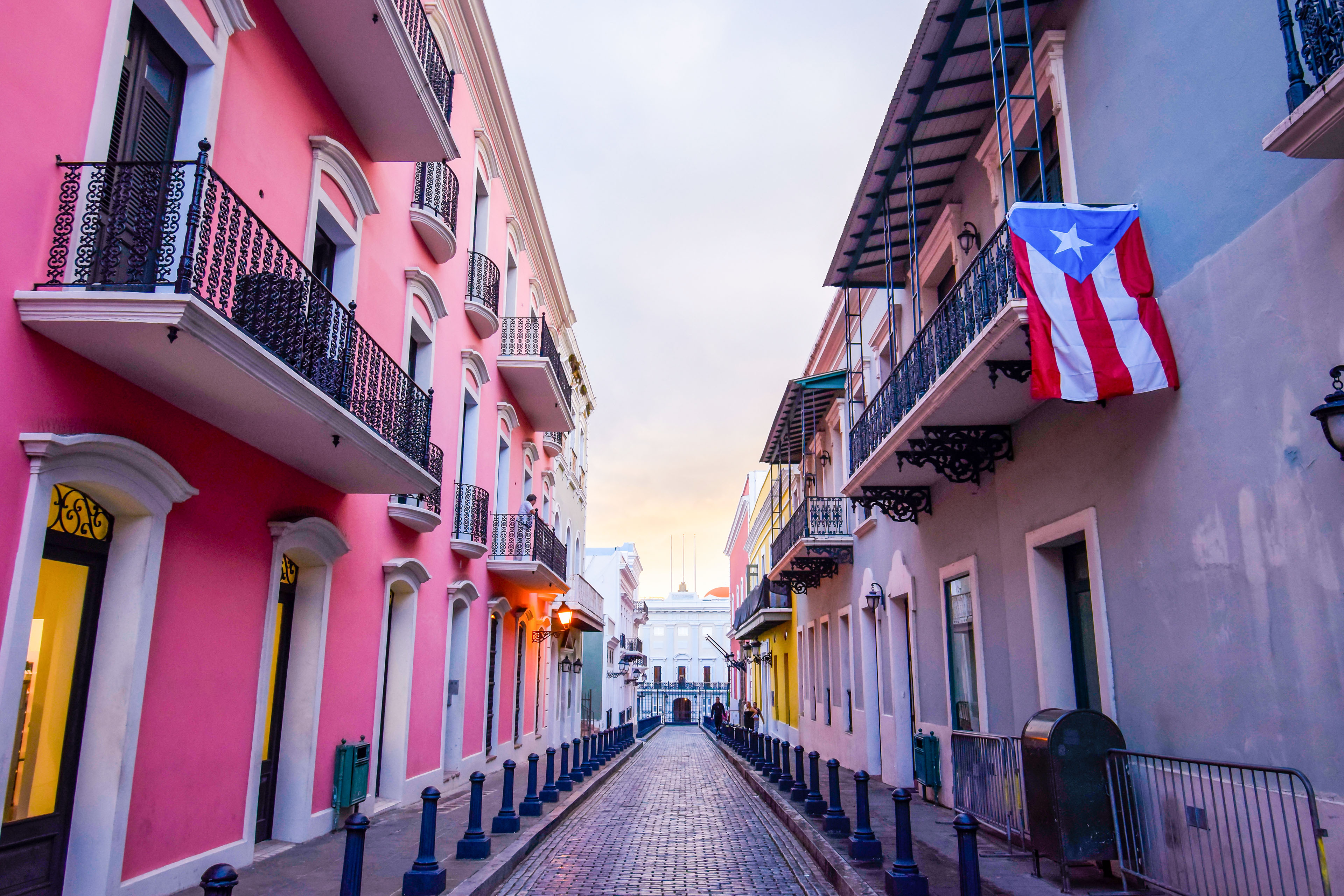
Puerto Rico, Spanish for rich port, is a U.S. territory in the Caribbean consisting of mountains, waterfalls, and the El Yunque rainforest. It is only 100 miles long by 35 miles wide, making it the smallest island of the Greater Antilles. Puerto Rico holds roughly 3.2 million residents, and San Juan, the capital and most populated city in Puerto Rico is where the highest amount of them reside. Puerto Rico has a tropical climate with little seasonal variation. It is hot, humid, and experiences a great amount of rainfall. The population is ethnically mixed because of centuries of immigration and cultural assimilation. Both Spanish and English are spoken there, but predominantly Spanish.


https://welcome.topuertorico.org

https://www.britannica.com/place/Puerto-Rico

Final Hazards Report

The main natural hazards of Puerto Rico are earthquakes and hurricanes. Although Puerto Rico has historically had moderate seismicity, the t...