 synthesis in GeoMapApp.")
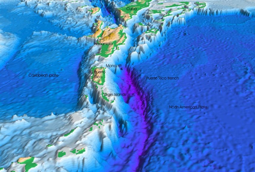
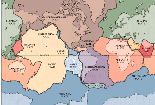
Puerto Rico is located on an active tectonic border where the Caribbean and North American plates meet. The northeastern corner of the Caribbean plate is migrating eastward at a rate of around two centimeters per year, on a strike-slip fault. A strike-slip fault occurs when blocks have typically shifted horizontally over vertical (or nearly vertical) fractures. Puerto Rico is located on a transform boundary, which happens when the margins of two plates glide past one another.
Puerto Rico is situated on a transform fault, which causes the plates to shift either horizontally or vertically. A massive transform fault that stretches from the Puerto Rico Trench to the coast of Central America is the result of the Caribbean and North American tectonic plates rubbing against one another. While the North American plate is moving west, the Caribbean plate is moving east.
The Caribbean plate's northern boundary is sub-parallel to the relative motion of the two plates, causing the plates to largely glide past one another. The North American plate is partially convergent with the Caribbean plate and is being indirectly subducted beneath Puerto Rico, however, the motion is somewhat oblique to the plate boundary.
The Puerto Rico Trench is connected to both the transform fault and a subduction zone. East of the trench, the larger Caribbean plate is being subducted beneath the larger North American plate, which carries the continent of North America and the northern Atlantic Ocean.
The region is very seismically active with an average of five earthquakes (including aftershocks) with a magnitude greater than 1.5 occurring near Puerto Rico every day during the last 12 months (March 2014-March 2015). Although the vast majority of these earthquakes are too small to be felt by people, these earthquakes provide evidence that the North American plate is moving westward relative to the Caribbean plate at about two centimeters/year.
Fun fact: Near the Puerto Rico trench, a vast fault system known as the Bunce Fault was found. The San Andreas Fault in California and the Bunce Fault are strikingly similar. Dr. Elizabeth (Betty) Bunce, a marine geophysicist who studied the Puerto Rico Trench in the 1950s, is honored with the name of the Bunce Fault.
https://oceanexplorer.noaa.gov/okeanos/explorations/ex1502/background/geology/welcome.html


Very nice tectonic set up!
ReplyDeleteHello Kailani, your writing was truly interesting, learning about how Puerto Rico has about five small earthquakes a year is crazy to me. It almost makes me feel that it would be nice to have it like that here in California so we would not be waiting for a massive one to hit every thirty years or so.
ReplyDeletehello kailani, it was interesting to read about puerto rico! ive always wanted to travel there and ill be sure to keep the weather conditions in mind!
ReplyDelete