
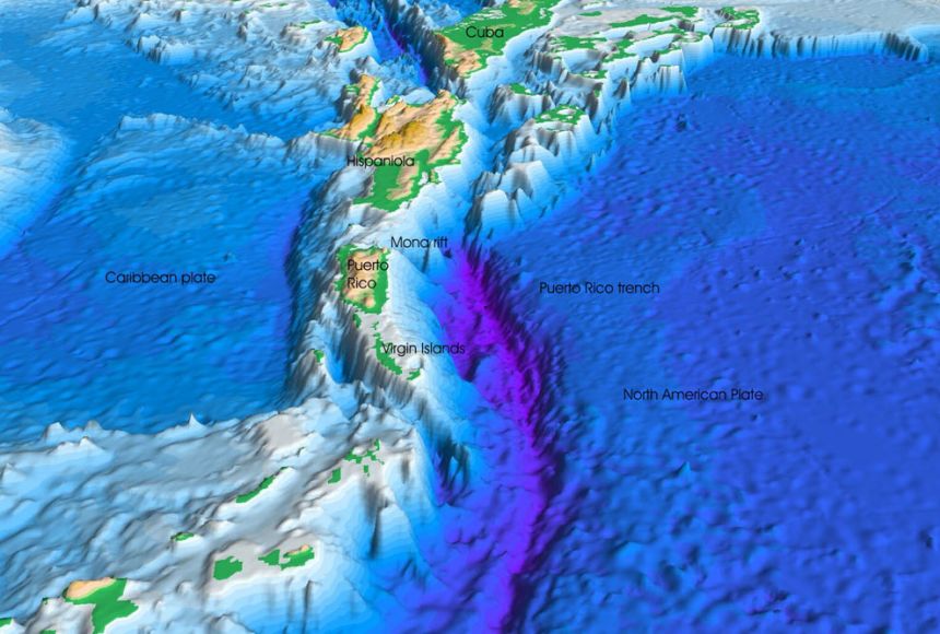
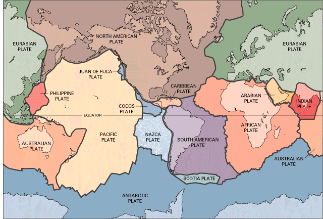
The main natural hazards of Puerto Rico are earthquakes and hurricanes. Although Puerto Rico has historically had moderate seismicity, the territory is tectonically active, thus rare big earthquakes are to be expected. A total of 576 earthquakes with a magnitude of four or above have struck within 300 kilometers (186 mi) of Puerto Rico in the past 10 years. This comes down to a yearly average of 57 earthquakes per year, or 4 per month. On average an earthquake will hit near Puerto Rico roughly every 6 days. These are being addressed as a priority because they occur so frequently and cause lots of damage.
Hurricanes strike Puerto Rico often, with a number that might seem abnormal to some because of how many have occurred in the past few years. From June to November, they pose a threat, with the season peaking in August and September. Puerto Rico has been hit by five hurricanes since 2020, three in 2020 and two in 2022. Since 2000, Puerto Rico has experienced 12 tropical storms or hurricanes. These are being addressed as a priority due to how much damage they cause and how often they occur.
To mitigate a catastrophic earthquake: through the Emergency Management Assistance Compact, the Commonwealth of Puerto Rico has asked the states of California and New York for help. The teams will offer technical support for building evaluations and inspections, as well as for the management and disposal of debris in the earthquake-affected districts. The limited infrastructure evaluation, security/reconnaissance activities, evacuation support, and route clearance operations are all being helped by the Puerto Rico National Guard. To help, more teams are on their way. Six temporary seismometers are being placed by the USGS along the coastline around the epicenters of the earthquakes. The ability to describe and anticipate earthquakes will be improved by data from aftershock monitoring devices. As the complicated and ongoing recovery from Hurricanes Irma and Maria continues, FEMA continues to assist the government of Puerto Rico. It also works to ensure that everyone is better prepared for catastrophes that could affect the island at all levels.
For hurricanes, nature-based solutions (NBS) are among the tools used by FEMA to mitigate hazards. Natural building systems (NBS) are planning, design, and engineering practices that incorporate natural features or processes into their construction. The NBS contains Articulated Cement Blocks (ACB), which are used in a variety of bridge and highway projects. With a more cost-effective and environmentally friendly vision, these blocks control erosion and support soil stabilization. This measure will benefit the bridge in Guayanilla's Vara de Perro sector. Over $271,000 in Hurricane Mara Public Assistance funds were set aside specifically for the installation of these blocks at the bridge's entrance, exit, and underside to prevent future structural damage from erosion. To date, FEMA has allocated nearly $1.8 billion in mitigation measures for Hurricane Maria projects under the Public Assistance program, as well as over $250 million in other HMGP projects aimed at mitigating Puerto Rico's infrastructure. Puerto Rico's economic and disaster recovery plan, which was submitted to Congress on August 8, 2018, attempts to address these various challenges while positioning Puerto Rico for future success.
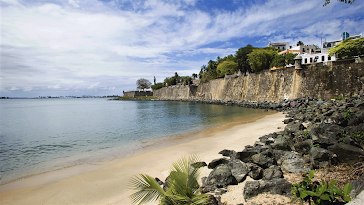
The most affected areas of Puerto Rico by hurricanes are on the East and West coasts, near Mayaguez and Fajardo. For earthquakes, the most affected areas are the cities of Arecibo, San Juan, Aguadilla, and Mayaguez. This is where the most earthquakes have occurred over time. These places listed are the most hazardous areas for earthquakes and hurricanes.
If I were to construct a home in Puerto Rico, I would construct it in San Sebastian, where little to no earthquakes and hurricanes occur. It also just so happens to be where my family is from, so this makes it an even easier decision. San Sebastian is located on the northwest part of the island, south of Isabela, Quebradillas, and Camuy; north of Las Marías; east of Moca and Añasco; and west of Lares.
https://www.weather.gov/sju/maria2017Links to an external site.
https://www.fema.gov/press-release/20230907/puerto-ricos-recovery-underway-hazard-mitigation-support#:~:text=To%20date%2C%20FEMA%20has%20allocated,solutions%20for%20Puerto%20Rico's%20infrastructureLinks to an external site..
https://www.weather.gov/sju/tropicalLinks to an external site.
https://www.rand.org/hsrd/hsoac/projects/puerto-rico-recovery/hurricanes-irma-and-maria.htmlLinks to an external site.
https://www.worlddata.info/america/puerto-rico/hurricanes.php#google_vignette
https://www.usgs.gov/news/featured-story/magnitude-64-earthquake-puerto-rico
https://www.fema.gov/press-release/20230425/fema-and-other-federal-agencies-supporting-earthquake-response-puerto-rico
https://en.wikipedia.org/wiki/List_of_earthquakes_in_Puerto_Rico


 synthesis in GeoMapApp.")


